How Mountains Move
Photos by Forrest Anderson, Donna Anderson and Seth Anderson
Persistence is the most powerful force on earth; it can move mountains.
— Albert Einstein
Wait, what? Do mountains really move? Is there nothing rock solid these days?
Mountains have symbolized constancy, dependability, and immovability to humans for thousands of years. The more we know about them, though, the more they reveal themselves as structures that grow, shrink, and change shape both slowly and precipitously.
Mountains also play an active, rather than a passive role, in the human world. They influence our weather patterns by both making and blocking rain, turning a valley on one side of them into a lush green paradise while the other side is a desert. Mountains store water and other valuable resources and provide protective barriers for us. They are critical habitat for trees and foliage that are the Earth’s lungs.
Throughout history, mountains have acted as borders between nations and communities, creating separate cultures with different languages and protecting from invaders. They provide refuge and protection for people “heading for the hills” in times of danger. Mountains have been the bane of armies that became trapped in ambushes at mountain passes or caught in winter snows that stopped them in their tracks. Ancient cities have been purposely built in locations where high mountains encircled them and provided natural protective barriers.
We climb up mountains like tiny ants, run roads and railways around them and tunnels through them, mine them of treasures, ski and bobsled down them for recreation and high-stakes international sports like the Olympics now playing out in China.
Our finest scenery involves mountains from Hawaii to the Rockies, Alps and Himalayas. But do we understand the forces that move them and the consequences of our own power to influence them?
Rising and Falling
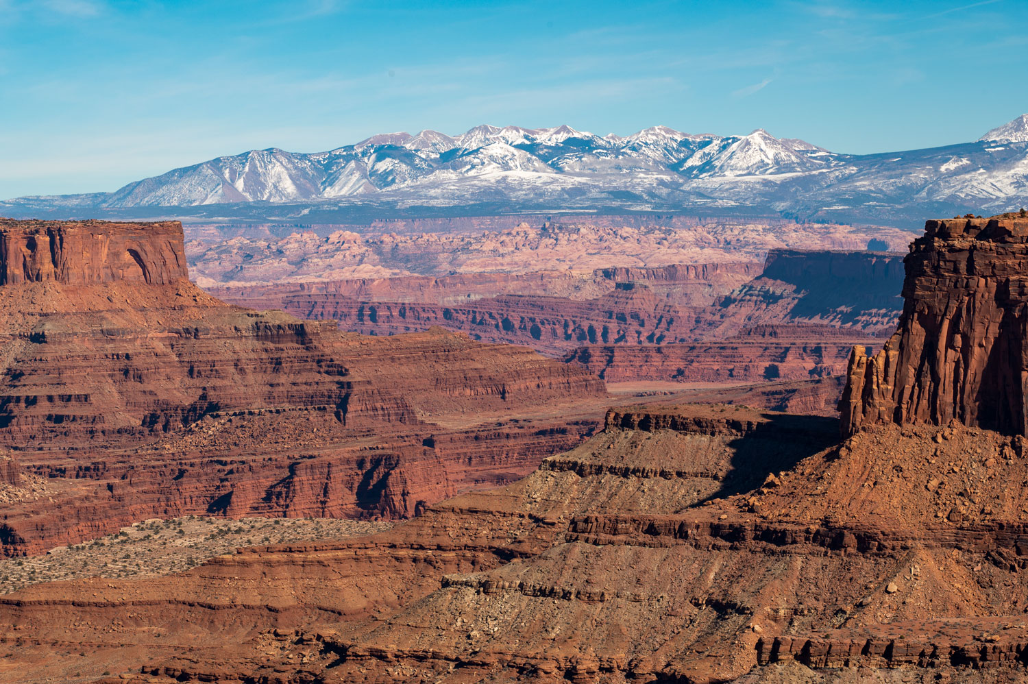
Most of us know that about 20 enormous sections of the Earth’s crust called tectonic plates float on a mantle of molten rock deep in the Earth. When they collide, mountain ranges crumple up at their intersections. But the story is much more complex than that. The collision of tectonic plates can result in different types of mountains.
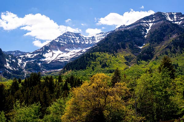
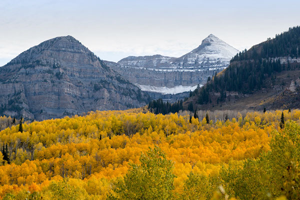
When two plates collide, they can both push up, like two cars locking bumpers and both rising off their front wheels. The plates in this type of a collision push rock up into mountains. This is how material that once was part of ancient seas, filled with fossils such as sea shells and coral, can end up on the top of a mountain. The Himalayans formed this way. The Tetons formed in a similar way, throwing up some of the oldest rock in the world to form the mountain range. The intense heat and pressure at great depths during this process changed sediments into rocks, separating different minerals into light and dark zebra-striped layers.
Molten magma squeezed into cracks in the old gneiss rock 2.5 billion years ago, and it cooled and crystalized to form igneous speckled granite. Peaks such as Mount Moran in the Tetons show stripes of darker and lighter gray where the granite cuts across the gneiss.
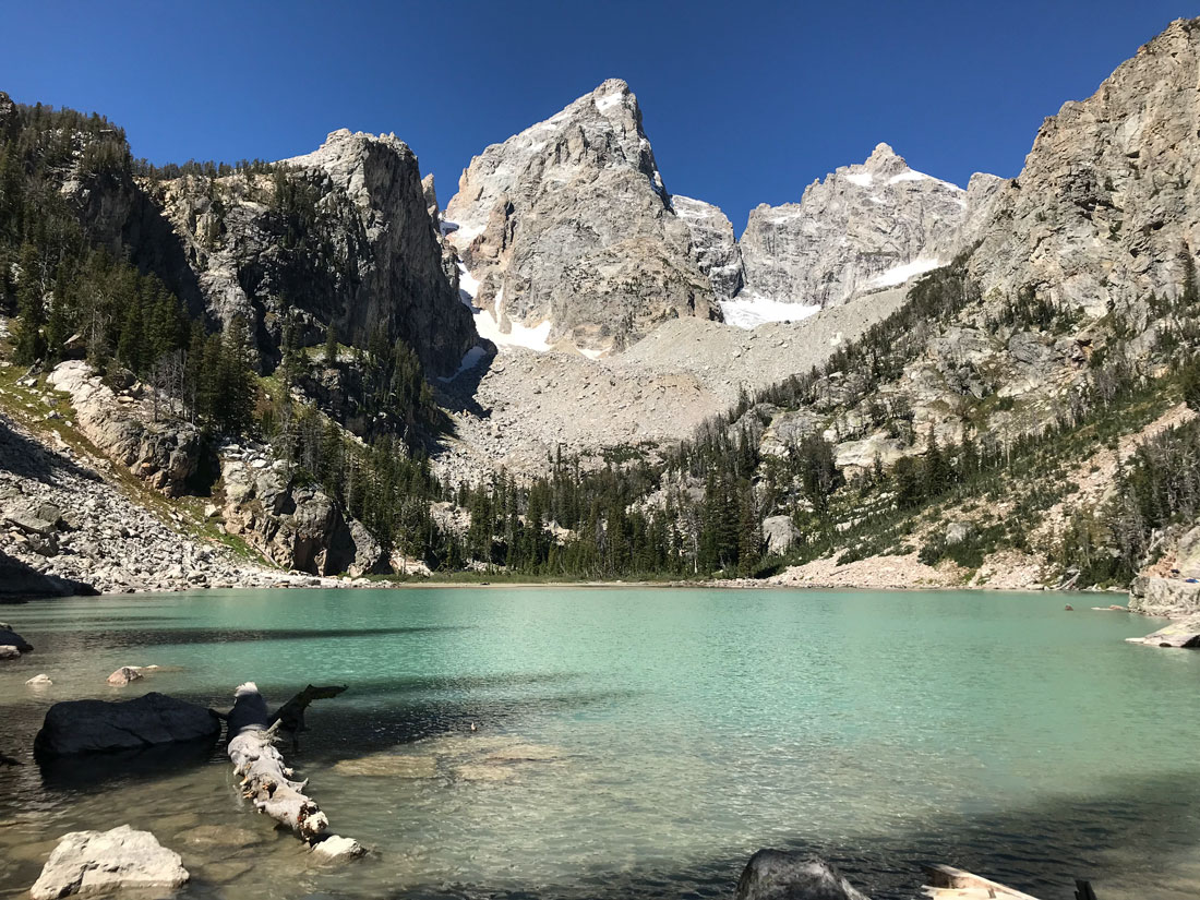
The Tetons.
Tectonics plates also can slide one over the other, a phenomenon that can cause chains of volcanoes to develop near the plates’ boundary. The Andes are an example. The Sierra Nevadas are similar – as one plate slid under the other, the lower plate slid entirely into the Earth’s mantle. The collision created a chain of volcanoes and then the Sierra Nevada mountain range. Scientists have recently discovered that the Sierra Nevadas formed twice as fast as they had earlier thought, over a period of 1.39 million years, as there was a massive flare-up of magma powering their creation.
Tectonic plates also can slide next to each other but in different directions, such as along the San Andreas fault in California which formed the Santa Cruz Mountains and other mountains in California, Oregon and Washington.
Plates also can hit each other and cause rock layers to fold up vertically or the layer on one side to curl over in a fold like a carpet pushed up against a wall. A single tectonic plate can have several of the different types of collisions.
Plate collisions trigger volcanic eruptions and earthquakes that have become some of the world’s most famous mountains, such as Mt. Fuji in Japan, Mt. Vesuvius and Mt. Etna in Italy, Krakatoa in Indonesia, Mt. Saint Helens in Washington, and Eyjafjallökull in Iceland. Volcanoes can either grow as lava erupts from their centers and then hardens into rock, or an eruption can blow off the top of a mountain and reduce its height.
Sometimes tectonic movement occurs far from a tectonic plate boundary. Some Mediterranean mountains are an example - part of what geologists call a mobile belt. Mantle material sinks at a plate boundary and then flows back and upward farther away from the boundary. It pushes on the crust, moving mountains both gradually and through earthquakes or eruptions. Researchers can detect these movements with GPS. The southern Meseta Central Plateau in Spain and the Massif Central in France were raised almost entirely by mantle flow. Other volcanic sites such as Mt. Etna and some volcanoes in China also may have formed this way.
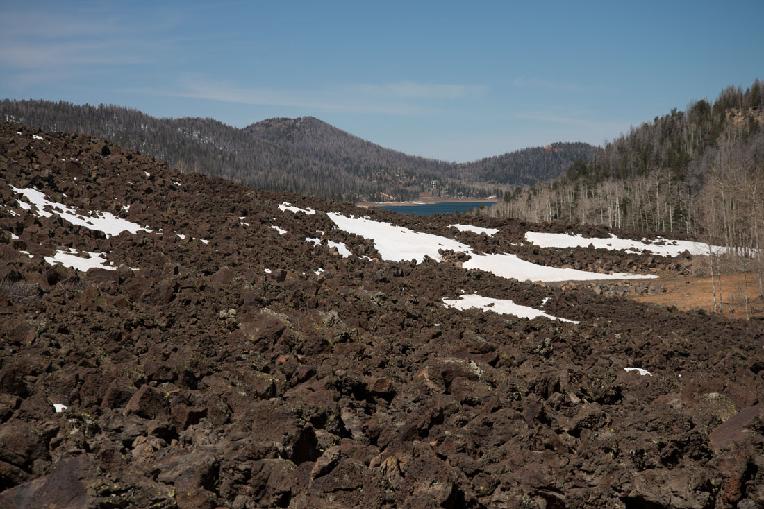
This lava field at Cedar Breaks National Monument in Utah formed when lava flowed from a weak area in the earth's crust.
When magma hardens before it breaks through the surface and erupts, it forms dome mountains. Then wind and rain pummels the domes, sculpting peaks and valleys such as the Black Hills of Dakota.
Wearing Down
A mountain’s height is the result of competition between the forces of uplift and those of weathering from water, wind, gravity and chemical erosion. The warmer it is, the faster rocks dissolve. Mountains can eventually erode down to plains.
Mountains are constantly lowered by rainfall and wind sculpting peaks and digging valleys. Traditionally, scientists believed that this process happened only very gradually over millions of years, but new research indicates that mountains can be eroded relatively quickly in some cases.
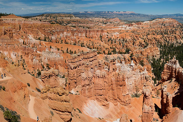
Plateaus are similar to mountains in some ways. They form as colliding tectonic plates push the land up without folding or faulting and then they are shaped by weathering and erosion that eats away softer rock, leaving deep canyons and magnificent rock formations in a layered landscape. People often give these fantastic formations names like Castle Rock because they remind them of castles. The analogy is appropriate because these formations are similar to the erosion of a sand castle as moving water causes some of the sand to wash away.
Zion National Park is one such phenomenon. Zion was a flat basin at about sea level 240 million years ago. Then sand, gravel and mud flowed from surrounding mountains into the basin in layers. The basin sank because of the weight of the materials. The area was shallow sea, then coastal plains, and finally a sandy desert as material accumulated on the basin. The material turned to limestone, mudstone, shale and sandstone because the weight of the sediment compacted the layers and chemicals in water filtering through the layers acted as cementing agents.
Exposed rock layers at the south entrance to Zion National Park.
Each layer of Zion’s cliffs is different in thickness, mineral content, color and eroded appearance.
Erosion is both mechanical and chemical. Mechanical erosion is a freeze-thaw cycle when water seeps into cracks, freezes and expands and cracks the rock into particles that get carried downstream by water. The rocks eventually dissolve and are carried into the ocean.
Zion is part of a huge area called the Grand Staircase that stretches between Bryce National Park in Utah and the Grand Canyon in Arizona where rock layers were deposited, then uplifted slowly by forces deep within the earth. The layers have interacted with streams flowing down steep areas. The water carries sediment and boulders that cut into the rock layers and have formed deep canyons.
There also have been volcanic eruptions in the park.
This vast area has eroded so unevenly that the top layer of rock at Zion National Park is the bottom layer at Bryce Canyon National Park, and Zion’s bottom layer is the top layer at the Grand Canyon. Wrap your head around that one.
The Earth’s Belly Button
As if all of this mountain movement isn’t weird enough, let’s add collisions with aliens from outer space.
Upheaval Dome in Canyonlands National Park, Utah, has been called the earth’s belly button because, well, it looks just like a belly button 3.4 miles in diameter when viewed in satellite photos and on geological maps.
Upheaval Dome.
The depression has old cream-colored domes in the center from which the earth slopes downward before sloping upward again at the sides, where there are progressively younger red rocks.
Scientists don’t know how this curious formation was created, but they have a couple of theories. The first is that a subsurface salt dome caused rock layers that overlay it to dome up in a circular pattern. These rock layers then eroded, leaving the belly button formation. The problem with this hypothesis is that there are no remaining traces of salt in the formation.
An alternative hypothesis is much more dramatic, that the crater was formed by a meteor from space that struck the earth about 60 million years ago. In this scenario, the dome’s middle would have been the central peak of the impact. Deformations of the rock and minerals consistent with a high-energy impact event that have been found in the dome support the meteor theory, but the evidence isn’t conclusive.
What is known is that craters formed by meteors aren’t all that uncommon. Earth is constantly bombarded by debris from outer space, most of which burns up during entry into our atmosphere. We sometimes see that in the form of meteor showers in the night sky.
Sometimes, however, an object is so large that it survives entry into the atmosphere to strike the earth’s surface and make a roughly circular hole. There are 190 confirmed structures like this on the Earth. Because of weathering and erosion, some are barely visible today.
The world’s largest is the Vredefort Crater in South Africa, which is between 111 and 186 miles wide. It is hard to tell exactly how large it is because it has been eroding for 2 billion years. The Barringer Crater was created 50,000 years ago when a massive meteor crashed into the Colorado Plateau and exploded with the force of two and a half million tons of TNT, excavating 175 million tons of rock. The crater has the distinction of being privately owned by the Barringer family. What to get for a family member who has everything….
Some mountain craters became lakes as water drained into them.
Scientists believe that an asteroid hit the Earth about 66 million years ago and drastically changed the planet’s landscape as well as wiping out the entire dinosaur population. Scientists theorize that the energy of the impact could have temporarily liquified the surface of the earth. When the asteroid hit, it created a 60-mile deep hole beneath the Earth’s surface. It may have smashed through the crust and into the mantle, causing rocks to be shot upward to twice the height of Mount Everest and then to pile up around the hole to create a ring of mountains. The event could have happened in five minutes.
Researchers have found pink granite around the rings of the crater caused by this event, which is called the Chicxulub Crater and is off the coast of Mexico. Pink granite is typically found deeper in the earth.
Craters of the Moon National Monument, Idaho
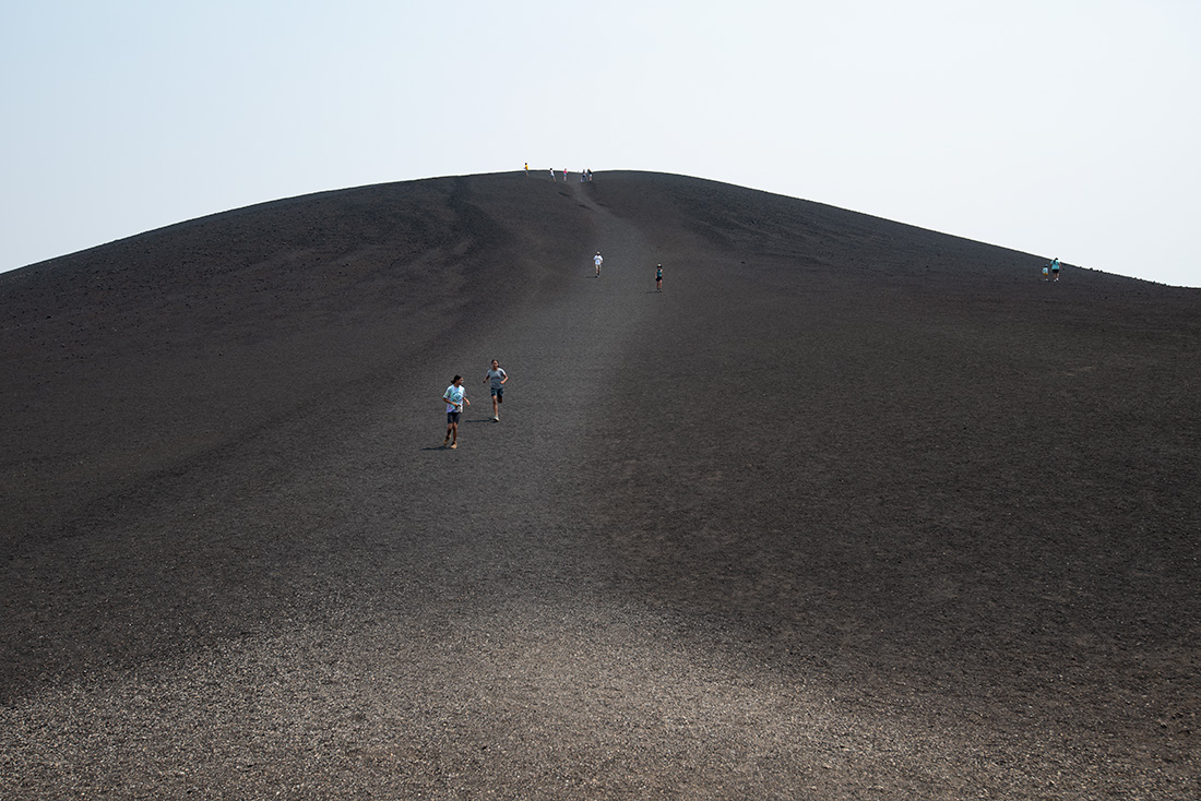
Interestingly, a formation called Craters of the Moon along the Great Rift of Idaho is not a meteorite crater like the craters on the moon are. This formation is instead three lava fields spread across 618 square miles between Boise, Idaho, and Yellowstone National Park. It includes 60 distinct solidified lava flows ranging in age from 15,000 to 2,000 years olds. It is the largest of several beds of lava that erupted in the Great Rift volcanic zone, a line of weakness in the Earth’s crust.
Because sparse rainfall in the area has not allowed the Craters of the Moon lava field to be covered with vegetation, it has remained a desolate black lava field. It was named before the landings on the moon during which NASA discovered that the moon’s surface was not cratered because of volcanic eruptions but by meteors.
Craters of the Moon was formed when a series of cataclysmic eruptions that formed calderas about 15 million years ago. A hot spot was under the area, and pressure from it heaved the land surface up, creating mountains that then subsided after the hot spot migrated elsewhere and relieved the upward pressure.
 Craters of the Moon.
Leftover heat from the hot spot later created overlapping lava flows at Craters of the Moon. The volcanic fissures at Craters of the Moon are considered dormant, not extinct, and could erupt again sometime in the next millennia.
Nature's Sculptors
Mountains vary widely in age. Despite the old stone from which they are created, the Tetons have been uplifting for less than 10 million years – teenagers compared to the middle-aged Rockies, which formed 50-80 million years ago, and the elderly Appalachians, which are more than 300 million years old. The Teton’s young age is the reason why their steep jagged peaks exist – they have not been worn away by erosion.
Glaciers are sculptors of mountain ranges. They sculpted the Tetons in the Pleistocene Ice Age by widening V-shaped canyons into U shapes and carving depressions that today are filled by lakes.
About 200,000 years ago, large ice sheets flowed off the Yellowstone Plateau through the Jackson Hole Valley, covering the valley with more than 2,000 feet of ice. The glaciers left behind plains of gravel and pebbles. Glaciers carry boulders, stones and gravel as they flow, grinding the rocks into powder. Water melting off the glaciers carried away fine sand and silt that forms topsoil in which sagebrush now grows.
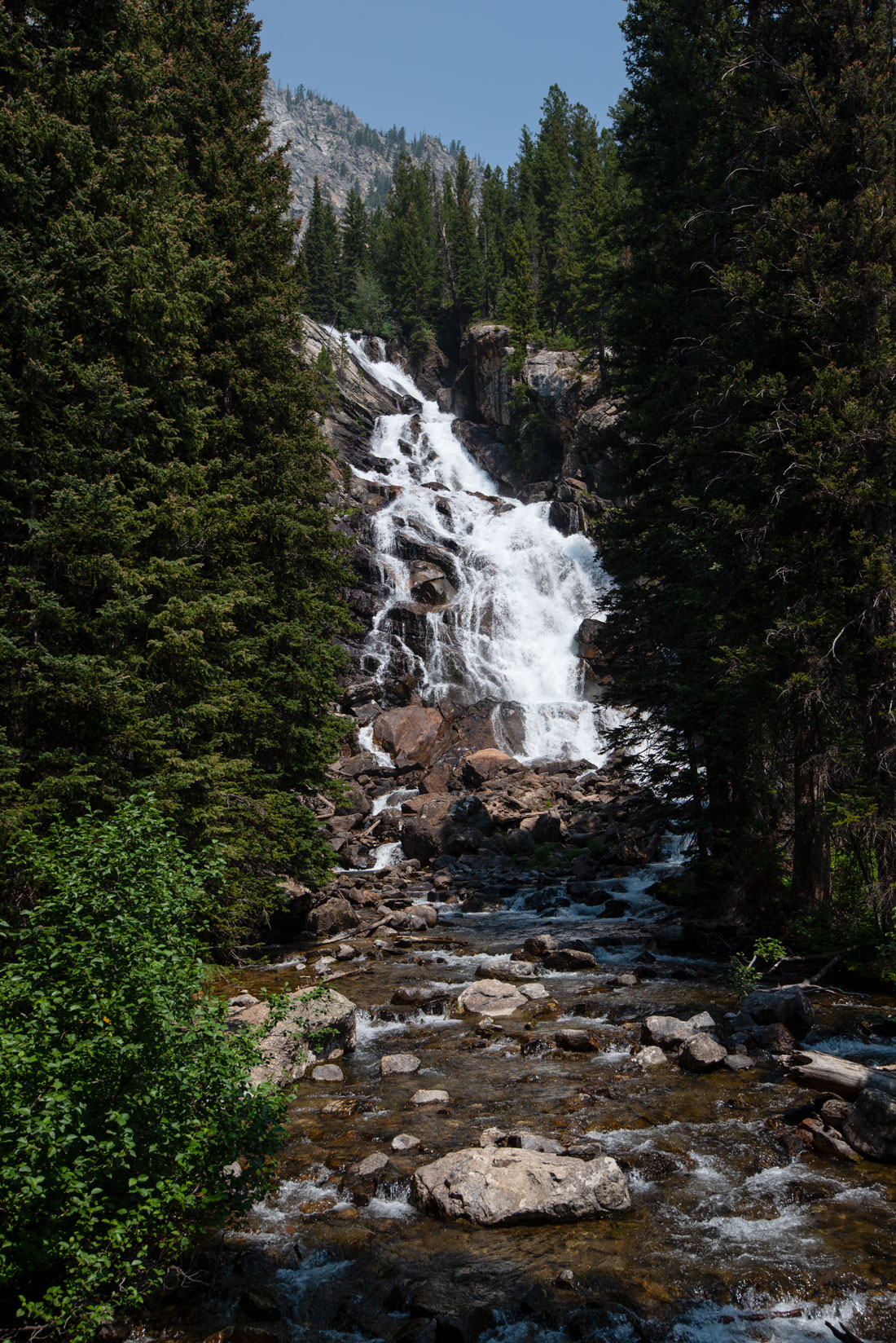
Hidden Falls in the Tetons. The forces of water continue to sculpt the mountains.
Human Mountain Movers
Average temperatures in American, European and Asian mountains have been rising by .54 degrees Fahrenheit per decade, a rate that is expected to continue at a faster rate in the future because of human-caused climate change. The temperature change is resulting in melting glaciers and changes in river flows that disrupt plants and wildlife. It also is increasing the risk of extreme rockslides and mountain floods that endanger wildlife and threaten people on mountains.
The rise in mountain range temperatures is expected to have a significant impact on water cycles, as snow accumulation zones shrink and change the timing of runoff. More water will flow down mountains immediately after rainfall, changing mountain river flows enough to throw off existing water storage and delivery infrastructures worldwide. More rain instead of snow will worsen the problem and also lead to flash flooding.
As glaciers melt, new lakes will form which will burst their banks and flood towns below them. The changed timing of the water flow will have a major impact on the availability of water for agriculture and hydropower. These problems are expected to worsen as temperatures rise.
Mountain ecosystems provide critical services to humans – sequestering CO2, cleaning water and the air and regulating flood waters. More than half of human society depends on mountains for their livelihoods, and mountains provide habitat for many species.
High-altitude mountain areas such as the Pyrenees are warming much faster than lowland regions because of climate change. The higher temperatures are accelerating biochemical reactions such as photosynthesis in plants, rates of decomposition and sedimentation, organic carbon mineralization and regrowth of grazed meadows. These changes are destabilising mountain ecosystems.
Increased flooding in some mountains because of climate change is releasing heavy metals that had been stored in frozen peatbogs and peatlands.
Toxic organic pollutants also are being carried from lowlands to sensitive mountain ecosystems by evaporation, cloud formation, wind and precipitation.
Introducing fish into mountain lakes has led to water systems being flooded with too many nutrients. With higher temperatures, this has caused algae to bloom, producing cyanotoxins in high enough concentrations to cause illness in animals and humans.
In other words, many mountain ranges are no longer as healthy and pristine as they appear. They are much more fragile than we realize.
In the future, they may no longer provide us with the clean drinking water, clean air and other ecosystem services we need. Scientists are warning that we may have to take more drastic measures to save mountain environments and the essential services they provide than we have hitherto done.
The Earth is literally moving under our feet – its crust being resurfaced over and over as mountains are thrust up and then erode into molehills, ocean floors spread and recede, volcanoes build new cones and blow others away, and earthquakes send rocks heaving and tumbling.
Our contribution to climate change means that we are influencing the process of mountains changing. We not only can but are moving mountains in ways that are forcing us to rethink the notion that both mountains and our own way of life are permanent.
Check out these related items
Yellowstone Roars Back To Life
As the pandemic wanes in the United States, the crowds have returned to Yellowstone National Park.
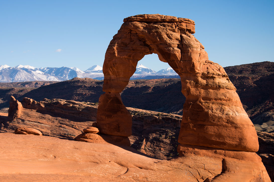
For the Love of Arches
Arches National Park in southeastern Utah is being loved to death, and the park service is scrambling to manage the attention.
Springtime in the Rockies
It's springtime in Utah's Rockies. Photographer Forrest Anderson captured the stunning scenery.
The Wasatch Back
The Wasatch Back is the chief year-round playground for residents of the booming Wasatch Front in Utah.
The Road Less Traveled
There's an alternative to the standard boring I-15 southern and I-80 northern routes across Nevada.