Water, Water Nowhere
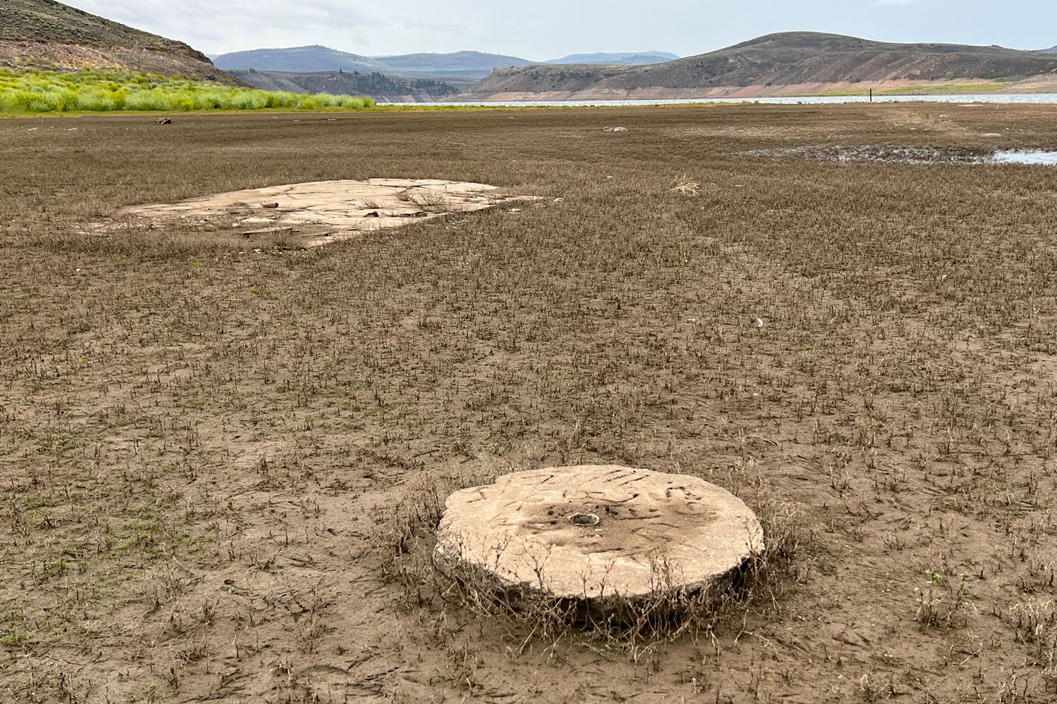
The town of Iola, Colorado, inundated in the 1960s by the Blue Mesa Reservoir, has emerged from the waters as the reservoir has been drained to shore up the Colorado River system amid a historic drought.
Photos by Forrest and Donna Anderson
“I was born underwater,” my father, who was born in Iola, Colorado, used to joke as we would pass by the Blue Mesa Reservoir in western Colorado.
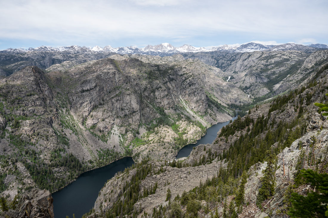
Iola, a small ranching town where he was born, was inundated by the waters of the reservoir in the 1960s. Its buildings were either moved to higher ground or disappeared under the waves.
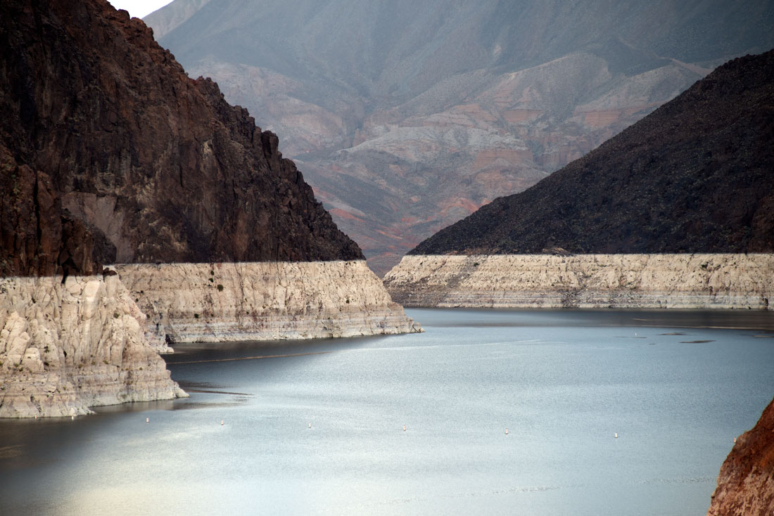
Not anymore. As Colorado’s largest body of water has receded in the face of the worst regional drought in 1,200 years, the old foundations of the Iola school that my dad attended and of a hotel where my great grandparents stayed when they arrived to take up ranching in Iola have emerged from the depths. The cement base of the school flagpole, into which students etched their initials, is visible during a walk on the lake shore along with building foundations, remains of ranch fence lines and scattered china shards.
A barren waterline where the water rose before the drought rings the hills around the reservoir.
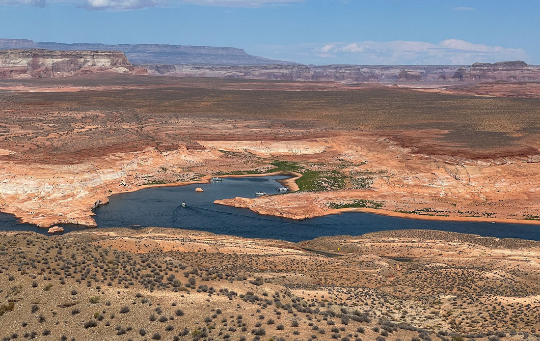
In an emergency response aimed at saving Lake Powell and hydroelectric power generation downstream, the federal government pulled 36,000 acre feet of water from Blue Mesa Reservoir in 2021. This drained the reservoir to about 60 feet lower than its usual level, and the reservoir has lost more water to Lake Powell this year.
Water also was drained from Flaming Gorge Reservoir in Wyoming and Navajo Lake in southwest Colorado to feed Lake Powell.
The water in Blue Mesa Reservoir is continuing to drop between two-four inches per day and will force the closure of all of its boat ramps by the end of October.
The reservoir isn’t the only thing in Colorado being drained. Agriculture, electric power generation, water supplies and the huge recreation industry that has long shored up the local economy along the Gunnison River also have been threatened by the water shortage, part of the broader shortage along the Colorado River and its tributaries.
Andy Mueller, Colorado River Water Conservation District general manager, said in September that if the Colorado River Basin’s seven states — Arizona, California, Colorado, Nevada, New Mexico, Utah and Wyoming — don’t reduce their water consumption along the river in the next three or four years, the reservoirs will be in crisis.
Although Bureau of Reclamation Commissioner Camille Touton instructed those states in June to reduce water consumption by up to 4 million acre-feet, but no agreements on how to do so have been reached. Under the 1922 Colorado River Compact, the seven states share 16 million acre-feet of water annually.
However, the drought has reduced the amount of water to 12 million acre feet, and that is likely to decrease further to 9 million acre feet as the drought continues.
The river is 1,450 miles long and supplies water to about 40 million people. The drop will cause major economic and environmental disruption.
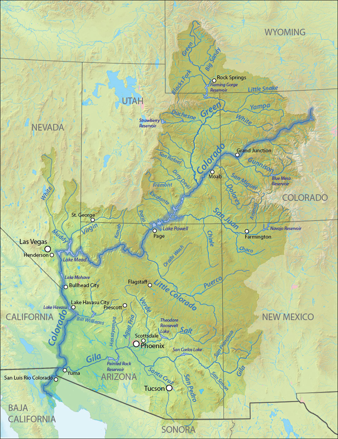
This map is available for use under a Creative Commons license.
This map shows the Colorado River Basin, the seven states and Mexico which use water from the river, the river's tributaries, and the reservoirs that are part of the system. Federal officials have tapped the Blue Mesa Reservoir and Flaming Gorge Reservoir in recent years to keep water levels in the Lake Powell reservoirs high enough to keep generating hydropower. However, Mueller said continuing to rely on those upstream reservoirs is not feasible. There are no plans for how the shortage will be handled when the reservoirs are depleted.
Flaming Gorge may have enough water left for only two more emergency releases, CNN reported.
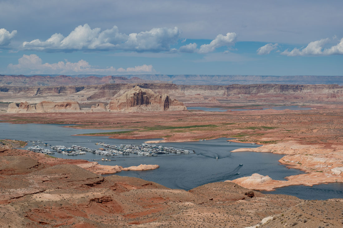
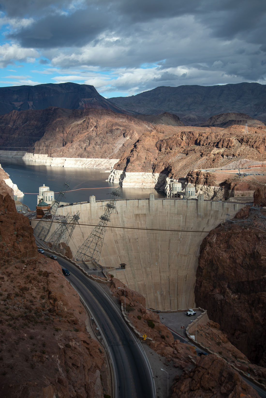
The water in Lake Powell is likely to fall too low soon for the Glen Canyon Dam to generate hydropower. The dam is a key energy source for 5.8 million homes and businesses. If it drops below 3,490 feet above sea level, the dam may be forced to cease generating power. The water level was just 39 feet above that this month, 24 percent of the lake’s capacity. A bathtub ring around the shores of the lake and other reservoirs in the Colorado River Basin records the water loss.
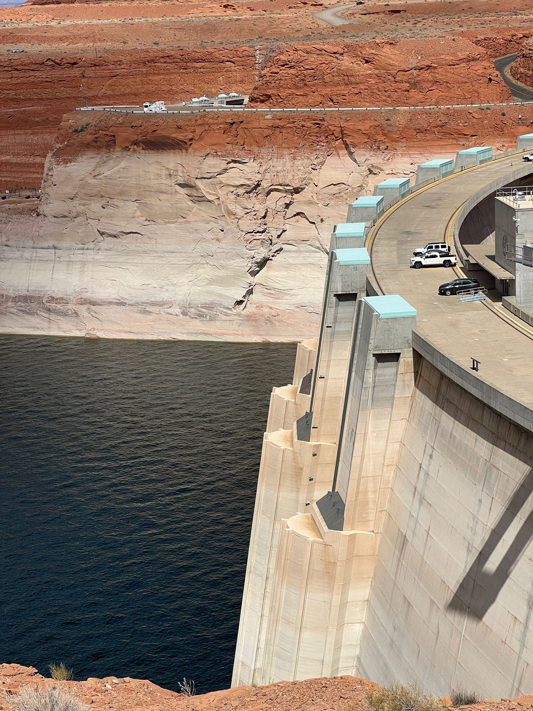
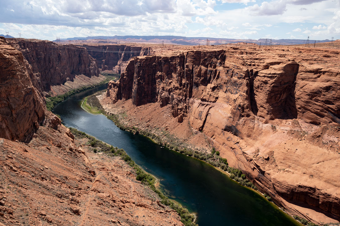
The Colorado River as it exits the Glen Canyon Dam at Lake Powell, its energy pouring into the electrical lines on the rim of Glen Canyon to power millions of homes and businesses in the region.
If there were a wetter-than-average winter this year, there wouldn’t be a need for more emergency releases immediately, but the priority wouldn’t be to add more water to Lake Powell but to recover water in the upstream reservoirs.
Water releases from Flaming Gorge and Blue Mesa Reservoir will continue until October, when Navajo Lake will increase releases through November and December.
The total capacity of the federal reservoirs of the Colorado River Basin is about 58 million acre feet. Fifty million of that is Lake Powell and Lake Mead. Combined, the reservoirs are at 34 percent of their capacity. The federal government announced additional water reductions for the Southwest starting in January 2023 because Lake Mead is at such a low level.
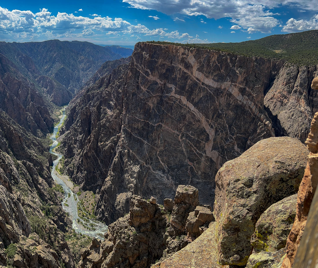
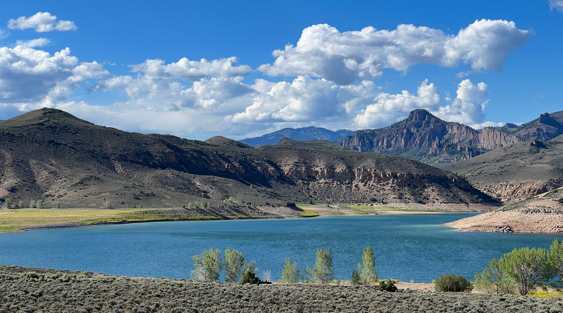
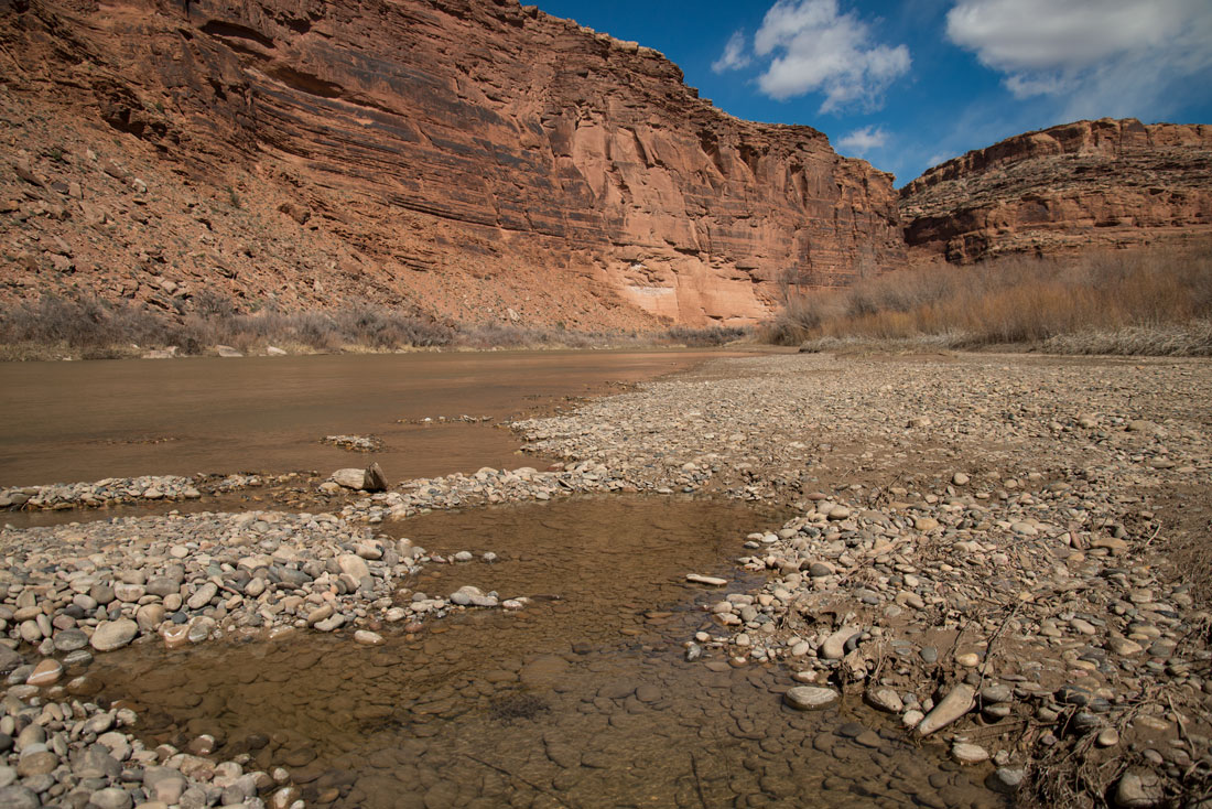
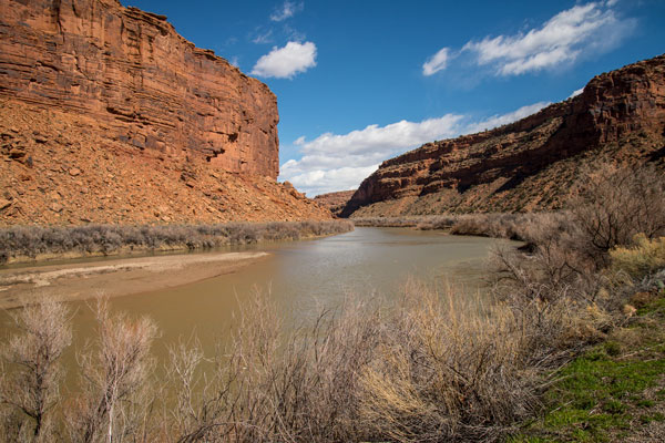
The Colorado River descends from the high Rockies of western Colorado through the Black Canyon. It joins the Colorado River in Grand Junction, Colorado (below).
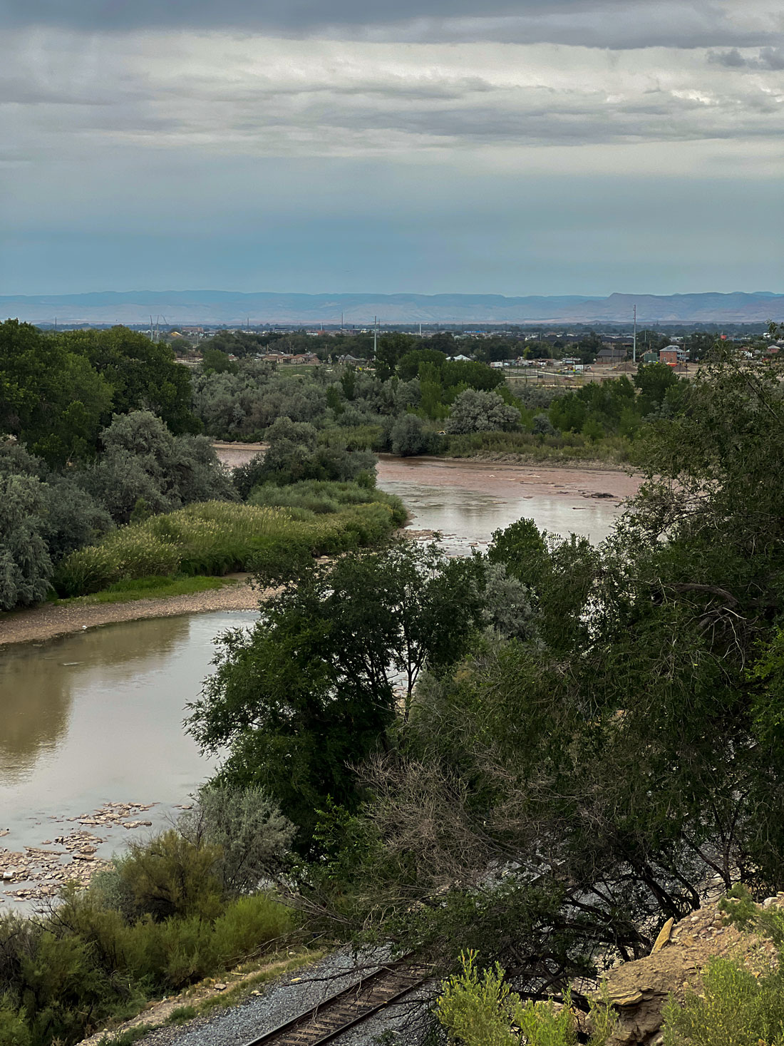
The Gunnison River which feeds the Blue Mesa Reservoir is one of the major tributaries of the Colorado River, meeting up with it in Grand Junction, Colorado.
The Colorado River and its tributaries are the lifeblood of the seven Western states. An Arizona State University study indicated that the Colorado River system supports 16 million jobs and annually contributes $1.4 trillion to the economies of the seven states.
Population growth throughout the arid Southwest, with its increasing demands for domestic water, power, and irrigation, has run headlong into climate change which has warmed temperatures in the high Rockies and reduced the snowmelt that feeds the river system.
Experts predict that snowmelt in Colorado will decline by half by 2090. In addition to lower levels of snow, the heat from climate change is melting snow earlier, pushing water flows into the river system earlier in the year and less dependably.
The recreation industry was a vital part of the Gunnison River economy long before the creation of the Blue Mesa Reservoir. My grandparents and great grandparents before them sold fishing licenses and acted as guides for fishermen and hunters for a tourist industry that has flourished since the 1880s when easterners and Europeans settled the area during a mining boom.
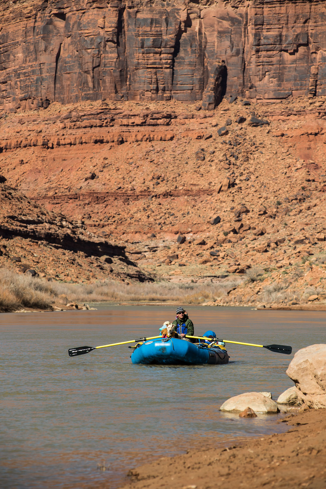
White water rafting alone generates some $190 million annually in Colorado, according to the Colorado River Outfitters Association. Hundreds of thousands of people raft in western Colorado on tributaries of the Colorado River. The rafting industry now has to carefully choose sections of the river with enough water.
Colorado Parks and Wildlife has asked fishermen not to fish in streams that are too warm or low. Warm temperatures can be fatal to cold-blooded trout, which are expected to seek higher habitat as the warming continues. At its current rate, temperatures are expected to be 1.8 degrees higher by 2050 and 5.5 degrees higher by 2100. That could mean a 31 percent loss of habitat for trout in the West.
Fishing contributes $2.4 billion and 17,000 jobs in Colorado. Less fishing, boating and rafting along the river system means a smaller tourist industry. Larger, hotter wildfires also are devastating natural trout habitat in other ways.
Draining more water from Colorado reservoirs also could affect the amount of water that ski areas on which mountain communities in western Colorado are dependent have available to make snow.
Many ranchers and farmers along the river are leaving land fallow because of lack of water. Las Vegas has outlawed growing lawns. Both electricity and grocery bills are expected to increase because of the shortage.
Water disputes are nothing new in the arid West. I have old records from my family’s ranches spelling out water rights shared between them and their neighbors, and fights over water rights were a legendary part of the old West.
However, “the challenges we are seeing today are unlike anything we have seen in our history,” U.S. Bureau of Reclamation Commissioner Camille Touton said during a June Senate hearing.
The chief solution is conservation, and the bureau told the states to come up with a plan to conserve between 2 million and 4 million acre-feet of water, more than Colorado’s entire share of the river’s water. The Upper Basin states, which include Colorado, Utah, New Mexico and Wyoming, argue that the Lower Basin states use twice as much water as they do and already are taking more than their fair share while the Upper Basin States take less. The upper basin states consume 3.5 million acre feet annually, and the three lower basin states use 8.5 million. The Upper Basin thinks the Lower Basin states should curtail their water use.
The Upper Basin states are open to doing better monitoring and measuring of water and to paying farmers and ranchers to take land out of production. Colorado also could pursue water storage options such as injecting water into the underground Denver aquifer and storing it there in wet years, using irrigation innovations, rotating fallow lands, and shifting crops, drilling and restoring wells to use more ground water, and treating more wastewater and gray water. The Upper Basin states could help the Lower Basin states pay for desalinization so that they could use less river water and more ocean and brackish inland water. All of the states can improve growth management and energy efficiency.
The Colorado is America’s most endangered river, according to the conservation nonprofit organization American Rivers. If the river system fails for lack of water, hydropower production on Lake Powell and Lake Mead will cease along with it.
The river is an important water resource for Phoenix, Las Vegas, Denver, Salt Lake City, Albuquerque, Los Angeles, San Diego, Mexicali in Baja California, hundreds of other cities, towns, and major agricultural areas including the Imperial Valley in California. The river’s drainage basin covers more than 244,000 square miles and comprises about a twelfth of the continental United States. More water is exported from the basin than from any other U.S. river. It provides irrigation water for 2 million acres of land. In addition to providing 4,000 megawatts of hydro-electric generating capacity, it supports more than 20 million annual visitor days of outdoor recreation. It’s the most regulated river in the world.
The Colorado River’s natural course is 1,450 miles long, starting in Rocky Mountain National Park and flowing into the ocean at the Gulf of California in Mexico. Along the way, tributaries from high up in the mountains in the Upper Basin states feed the river.
Water from as far away as Bridger Wilderness and Fremont Lake, Wyoming, flows into the Colorado River and down to the thirsty Southwest.
However, the water doesn’t flow as far as the Gulf of California because it’s diverted in so many places and a significant amount evaporates as it flows through arid canyons. This is worsening as temperatures rise.
The drought is priming the land for larger, faster wildfires. Megafires in the watersheds are creating soils that water can’t penetrate, so rains run off quickly. Waterways flood banks and damage roads and other infrastructure as well as triggering rock and debris slides on highways. It costs millions of dollars to repair this damage.
Booms with collection barriers that extend under the water have been set up to collect large debris that washes into reservoirs so it won’t go into the system. Water systems still are dealing with silt and debris from fires that burned 25 years ago.
The bureau’s authority over Blue Mesa, Flaming Gorge and Navajo reservoirs was not questioned when the emergency water releases were done because they store water used specifically to help the Upper Basin meet its delivery obligations to the Lower Vasin. However, federal government authority is unclear in the case of dozens of small Reclamation projects and thousands of individual users on private ditch systems. Colorado administers this complex water rights system under the state doctrine of prior appropriation, which means that older water rights get first use of the river.
The Lower Basin has about 20 diversions, including about half a dozen large ones, from the Colorado River. Each entity that uses water from Lake Mead has a contract with the Bureau of Reclamation.
The Upper Basin’s position is that the Lower Basin has the responsibility to save 2-4 million acre-feet.
Although the Gunnison River Basin snow water equivalent was 96 percent of normal last year, precipitation ranged between 69% and 82% of average for the entire Upper Basin. Storage in the entire Upper Colorado River Basin was 63% of average last spring, and Blue Mesa and Lake Powell were the lowest in that system.
The Blue Mesa Dam was completed in 1966 as a part of the Bureau of Reclamation’s Colorado River Storage Project to collect water from the river and its tributaries for agricultural, municipal and power generation across the Southwest. My parents both worked on the dam construction.
The dam on the Gunnison River east of the Black Canyon of the Gunnison National Park helps control the amount of water flowing into the Colorado River for water storage and flood control purposes and also generates hydroelectric power. The Gunnison River is the fifth largest tributary of the Colorado River.
The dam was built about 30 miles west of Gunnison at a narrows in the river valley where the Gunnison River enters the upper reaches of the Black Canyon of the Gunnison. The dam created the Blue Mesa Reservoir, Colorado’s largest lake.
The National Park Service developed and manages boat ramps, campgrounds and marinas at the reservoir. The reservoir is Colorado’s largest lake trout and Kokanee salmon fishery. The boating season was cancelled in 2022 because of the reservoir’s low water level.
While the dam was being built, about 200-300 people were moved, some from ranches that had been in their families for three or four generations. A ranch my family had previously owned for three generations was partially inundated by the reservoir. However, most people in the area, including my family, thought that the dam and reservoir would boost the economy and help manage water in the arid region.
The two-decade-long megadrought has been a double whammy for the reservoir, because dry conditions have led to lower levels of snowmelt in the lake, but what water was flowing in also has been drained to help maintain levels in Lake Powell. Lake Powell, the second-largest reservoir in the United States, hit its lowest level ever recorded earlier this summer.
Officials say the Blue Mesa Reservoir won’t be full for a long time, if ever, because of the climate change-caused drought. There are no trends that point toward alleviation of the drought.
Check out these related items
The River That Keeps on Giving
The mammoth Colorado River is the lifeblood of the southwest United States, supplying water and power for cities and agriculture.
The Booming and Broiling Southwest
The American Southwest is the fastest growing region in the United States, but also the hottest and most arid.
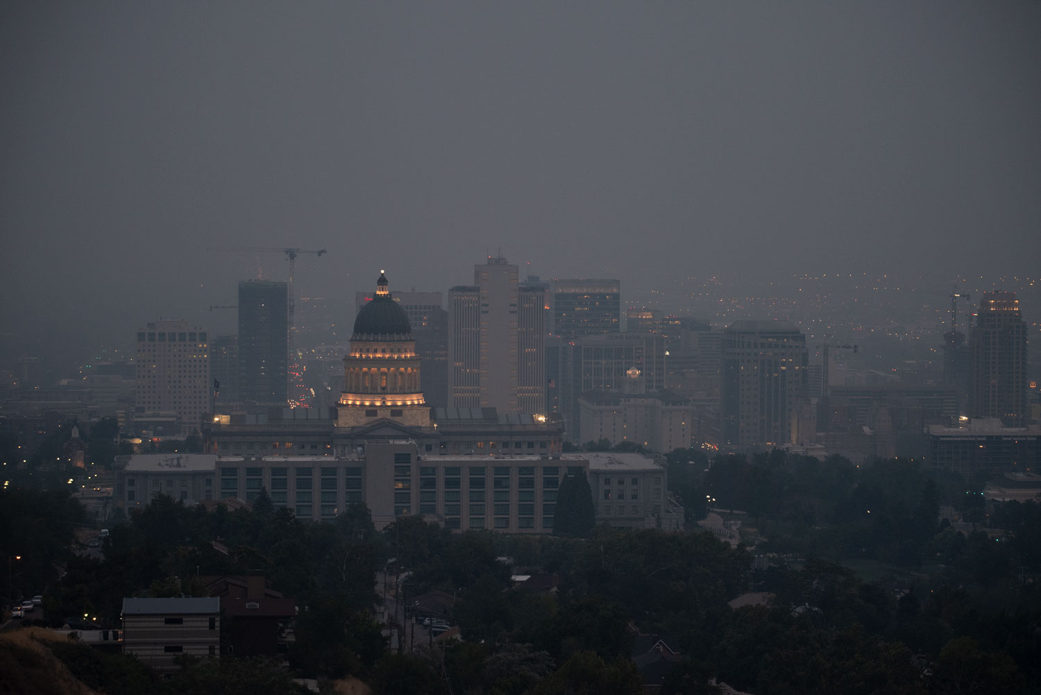
The Day the Mountains Disappeared
Salt Lake City, Utah, was the seventh most polluted city in the world last Friday, shrouded in smoke from California wildfires.
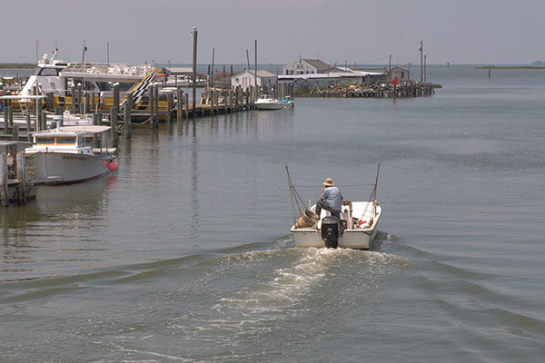
The Chesapeake’s Shrinking Isle
Smith Island in the Chesapeake Bay is rich in history but shrinking in land and population.

Sustainable Clothing
The trade war with China. Environment degradation. Household debt. To bring all of them into focus, we can look in our closets.
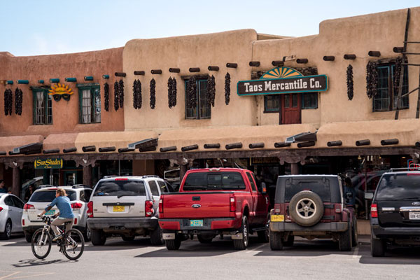
Sustainable Tourism for Holidays
Packing for travel this holiday season should include a primer on how to be responsible, sustainable tourists. Here it is.